02
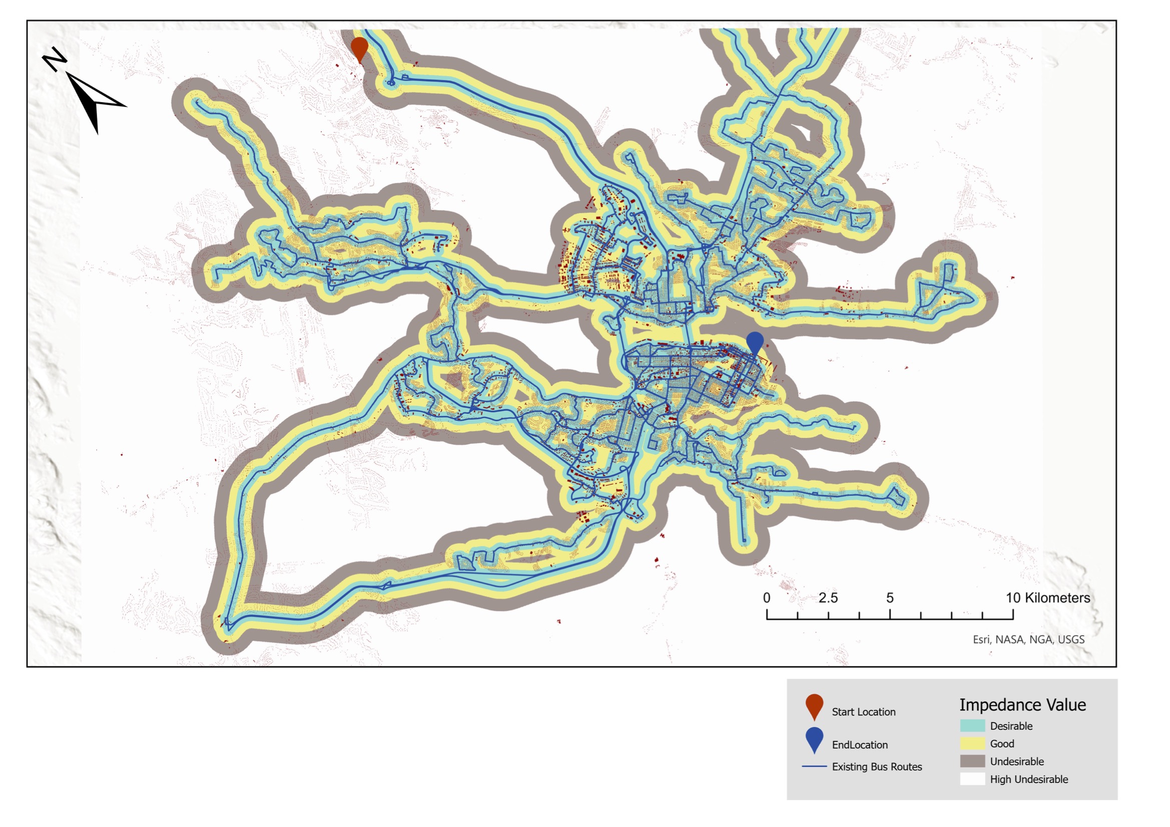
Where should Halifax run its next light-rail corridor?
GIS-based multi-criteria least-cost-path analysis for a proposed Light Rail Transit alignment through Halifax Regional Municipality.
View project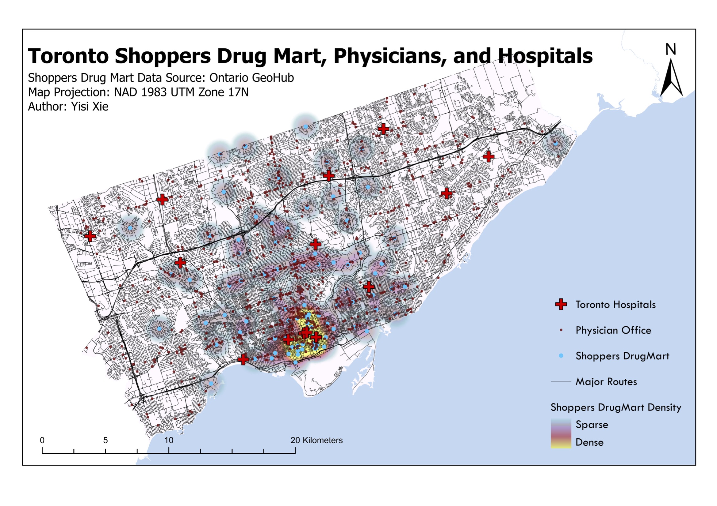
03
How equitably does Toronto distribute its pharmacies, doctors, and hospitals?
A density-based reading of Shoppers Drug Mart pharmacies, physician offices, and hospitals across Toronto's neighbourhoods.
View project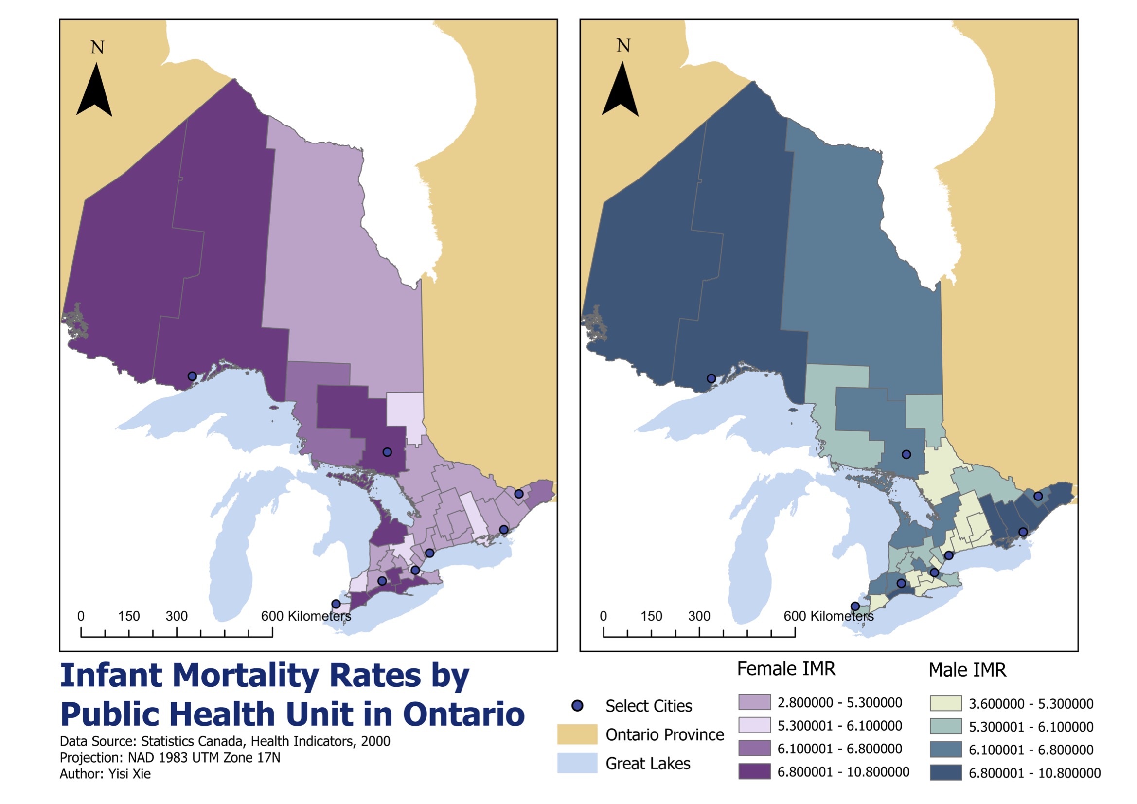
04
Where in Ontario do infant mortality and road-collision risks cluster?
Choropleth mapping of infant mortality rates across Ontario and LISA cluster analysis of child and senior road-collision risks.
View project